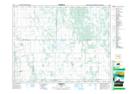
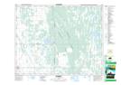
Maps showing Big Grass River Angle Ditch, 24-18-13-W, Manitoba
Big Grass River Angle Ditch is a Hydraulic construction located in 24-18-13-W, Manitoba.
- Latitude: 50° 33' 27'' North (decimal: 50.5575000)
- Longitude: 99° 8' 21'' West (decimal: -99.1392000)
- Topography Feature Category: Hydraulic construction
- Geographical Feature: Ditch
- Canadian Province/Territory: Manitoba
- Location: 24-18-13-W
- Atlas of Canada Locator Map: Big Grass River Angle Ditch
- GPS Coordinate Locator Map: Big Grass River Angle Ditch Lat/Long
Big Grass River Angle Ditch NTS Map Sheets