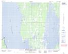
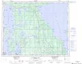
Maps showing Big Hunters Island, Manitoba
Big Hunters Island is a Island located in Manitoba and has an elevation of 262 meters.
- Latitude: 52° 12' 55'' North (decimal: 52.2153000)
- Longitude: 99° 33' 21'' West (decimal: -99.5557999)
- Topography Feature Category: Island
- Geographical Feature: Island
- Canadian Province/Territory: Manitoba
- Elevation: 262 meters
- Atlas of Canada Locator Map: Big Hunters Island
- GPS Coordinate Locator Map: Big Hunters Island Lat/Long
Big Hunters Island NTS Map Sheets