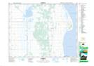
Maps showing Big Point, 16-8-W, Manitoba
Big Point is a Cape located in 16-8-W, Manitoba.
- Latitude: 50° 24' 7'' North (decimal: 50.4019000)
- Longitude: 98° 31' 17'' West (decimal: -98.5213999)
- Topography Feature Category: Cape
- Geographical Feature: Point
- Canadian Province/Territory: Manitoba
- Location: 16-8-W
- Atlas of Canada Locator Map: Big Point
- GPS Coordinate Locator Map: Big Point Lat/Long