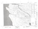
Maps showing Big Stone Point, 44-1-E, Manitoba
Big Stone Point is a Cape located in 44-1-E, Manitoba and has an elevation of 223 meters.
- Latitude: 52° 45' 30'' North (decimal: 52.7582999)
- Longitude: 97° 20' 19'' West (decimal: -97.3386000)
- Topography Feature Category: Cape
- Geographical Feature: Point
- Canadian Province/Territory: Manitoba
- Elevation: 223 meters
- Location: 44-1-E
- Atlas of Canada Locator Map: Big Stone Point
- GPS Coordinate Locator Map: Big Stone Point Lat/Long
Big Stone Point NTS Map Sheets