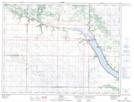
Maps showing The Big Tiger, 11-6-18-W, Manitoba
The Big Tiger is a Mountain located in 11-6-18-W, Manitoba and has an elevation of 474 meters.
- Latitude: 49° 28' 26'' North (decimal: 49.4739000)
- Longitude: 99° 47' 58'' West (decimal: -99.7994000)
- Topography Feature Category: Mountain
- Geographical Feature: Hill
- Canadian Province/Territory: Manitoba
- Elevation: 474 meters
- Location: 11-6-18-W
- Atlas of Canada Locator Map: The Big Tiger
- GPS Coordinate Locator Map: The Big Tiger Lat/Long