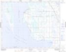
Maps showing Birch Creek, 15-29-8-W, Manitoba
Birch Creek is a River located in 15-29-8-W, Manitoba and has an elevation of 259 meters.
- Latitude: 51° 28' 50'' North (decimal: 51.4805999)
- Longitude: 98° 30' 26'' West (decimal: -98.5072000)
- Topography Feature Category: River
- Geographical Feature: Creek
- Canadian Province/Territory: Manitoba
- Elevation: 259 meters
- Location: 15-29-8-W
- Atlas of Canada Locator Map: Birch Creek
- GPS Coordinate Locator Map: Birch Creek Lat/Long
Birch Creek NTS Map Sheets