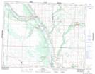
Maps showing Birtle, 6-17-26-W, Manitoba
Birtle is a Town located in 6-17-26-W, Manitoba and has an elevation of 489 meters.
- Latitude: 50° 25' 21'' North (decimal: 50.4225000)
- Longitude: 101° 2' 51'' West (decimal: -101.0475000)
- Topography Feature Category: Town
- Geographical Feature: Town
- Canadian Province/Territory: Manitoba
- Elevation: 489 meters
- Location: 6-17-26-W
- Atlas of Canada Locator Map: Birtle
- GPS Coordinate Locator Map: Birtle Lat/Long
Birtle NTS Map Sheets