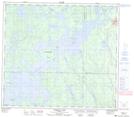
Maps showing Bissett Island, 85-18-W, Manitoba
Bissett Island is a Island located in 85-18-W, Manitoba and has an elevation of 272 meters.
- Latitude: 56° 23' 44'' North (decimal: 56.3955999)
- Longitude: 100° 15' 44'' West (decimal: -100.2622000)
- Topography Feature Category: Island
- Geographical Feature: Island
- Canadian Province/Territory: Manitoba
- Elevation: 272 meters
- Location: 85-18-W
- Atlas of Canada Locator Map: Bissett Island
- GPS Coordinate Locator Map: Bissett Island Lat/Long
Bissett Island NTS Map Sheets