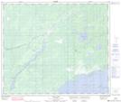
Maps showing Black Duck Lake, 62,63-8-W, Manitoba
Black Duck Lake is a Lake located in 62,63-8-W, Manitoba and has an elevation of 213 meters.
- Latitude: 54° 24' 39'' North (decimal: 54.4107999)
- Longitude: 98° 36' 57'' West (decimal: -98.6157999)
- Topography Feature Category: Lake
- Geographical Feature: Lake
- Canadian Province/Territory: Manitoba
- Elevation: 213 meters
- Location: 62,63-8-W
- Atlas of Canada Locator Map: Black Duck Lake
- GPS Coordinate Locator Map: Black Duck Lake Lat/Long
Black Duck Lake NTS Map Sheets