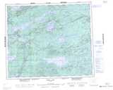
Maps showing Black Rabbit Lake, 69,3-4-,W2, Manitoba
Black Rabbit Lake is a Lake located in 69,3-4-,W2, Manitoba and has an elevation of 216 meters.
- Latitude: 55° 0' 38'' North (decimal: 55.0105999)
- Longitude: 96° 58' 59'' West (decimal: -96.9830999)
- Topography Feature Category: Lake
- Geographical Feature: Lake
- Canadian Province/Territory: Manitoba
- Elevation: 216 meters
- Location: 69,3-4-,W2
- Atlas of Canada Locator Map: Black Rabbit Lake
- GPS Coordinate Locator Map: Black Rabbit Lake Lat/Long
Black Rabbit Lake NTS Map Sheets
063I14 White Rabbit Lake Topographic Map at 1:50,000 scale
063I15 Bjornson Lake Topographic Map at 1:50,000 scale
063P02 Cotton Lake Topographic Map at 1:50,000 scale
063P03 Bulger Lake Topographic Map at 1:50,000 scale
063I Cross Lake Topographic Map at 1:250,000 scale
063P Sipiwesk Topographic Map at 1:250,000 scale
063I15 Bjornson Lake Topographic Map at 1:50,000 scale
063P02 Cotton Lake Topographic Map at 1:50,000 scale
063P03 Bulger Lake Topographic Map at 1:50,000 scale
063I Cross Lake Topographic Map at 1:250,000 scale
063P Sipiwesk Topographic Map at 1:250,000 scale