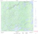
Maps showing Black Smith Rapids, Manitoba
Black Smith Rapids is a Rapids located in Manitoba.
- Latitude: 57° 19' 55'' North (decimal: 57.3319000)
- Longitude: 98° 56' 16'' West (decimal: -98.9377999)
- Topography Feature Category: Rapids
- Geographical Feature: Rapids
- Canadian Province/Territory: Manitoba
- Atlas of Canada Locator Map: Black Smith Rapids
- GPS Coordinate Locator Map: Black Smith Rapids Lat/Long
Black Smith Rapids NTS Map Sheets