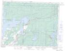
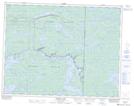
Maps showing Blind Bay, Manitoba
Blind Bay is a Bay located in Manitoba and has an elevation of 303 meters.
- Latitude: 50° 18' 18'' North (decimal: 50.3049999)
- Longitude: 95° 30' 00'' West (decimal: -95.4999999)
- Topography Feature Category: Bay
- Geographical Feature: Bay
- Canadian Province/Territory: Manitoba
- Elevation: 303 meters
- Atlas of Canada Locator Map: Blind Bay
- GPS Coordinate Locator Map: Blind Bay Lat/Long
Blind Bay NTS Map Sheets