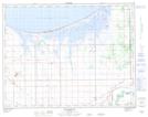
Maps showing Bluebill Bay, Manitoba
Bluebill Bay is a Bay located in Manitoba and has an elevation of 249 meters.
- Latitude: 50° 11' 42'' North (decimal: 50.1949999)
- Longitude: 98° 8' 48'' West (decimal: -98.1466999)
- Topography Feature Category: Bay
- Geographical Feature: Bay
- Canadian Province/Territory: Manitoba
- Elevation: 249 meters
- Atlas of Canada Locator Map: Bluebill Bay
- GPS Coordinate Locator Map: Bluebill Bay Lat/Long