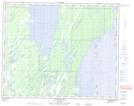
Maps showing Blue Heron Island, 40-21-W, Manitoba
Blue Heron Island is a Island located in 40-21-W, Manitoba.
- Latitude: 52° 25' 52'' North (decimal: 52.4311000)
- Longitude: 100° 22' 15'' West (decimal: -100.3707999)
- Topography Feature Category: Island
- Geographical Feature: Island
- Canadian Province/Territory: Manitoba
- Location: 40-21-W
- Atlas of Canada Locator Map: Blue Heron Island
- GPS Coordinate Locator Map: Blue Heron Island Lat/Long
Blue Heron Island NTS Map Sheets