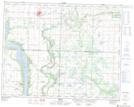
Maps showing Bluewing Swamp, 24-27-W, Manitoba
Bluewing Swamp is a Low vegetation located in 24-27-W, Manitoba and has an elevation of 577 meters.
- Latitude: 51° 4' 14'' North (decimal: 51.0706000)
- Longitude: 101° 9' 28'' West (decimal: -101.1578000)
- Topography Feature Category: Low vegetation
- Geographical Feature: Swamp
- Canadian Province/Territory: Manitoba
- Elevation: 577 meters
- Location: 24-27-W
- Atlas of Canada Locator Map: Bluewing Swamp
- GPS Coordinate Locator Map: Bluewing Swamp Lat/Long
Bluewing Swamp NTS Map Sheets