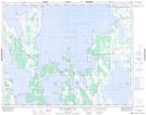
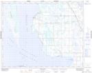
Maps showing The Bluff, 8,17-26-10-W, Manitoba
The Bluff is a Cliff located in 8,17-26-10-W, Manitoba and has an elevation of 266 meters.
- Latitude: 51° 12' 38'' North (decimal: 51.2106000)
- Longitude: 98° 51' 17'' West (decimal: -98.8547000)
- Topography Feature Category: Cliff
- Geographical Feature: Bluff
- Canadian Province/Territory: Manitoba
- Elevation: 266 meters
- Location: 8,17-26-10-W
- Atlas of Canada Locator Map: The Bluff
- GPS Coordinate Locator Map: The Bluff Lat/Long
The Bluff NTS Map Sheets