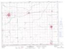
Maps showing Blumengart, 15,16-2-3-W, Manitoba
Blumengart is a Unincorporated area located in 15,16-2-3-W, Manitoba and has an elevation of 261 meters.
- Latitude: 49° 7' 58'' North (decimal: 49.1327999)
- Longitude: 97° 47' 45'' West (decimal: -97.7957999)
- Topography Feature Category: Unincorporated area
- Geographical Feature: Locality
- Canadian Province/Territory: Manitoba
- Elevation: 261 meters
- Location: 15,16-2-3-W
- Atlas of Canada Locator Map: Blumengart
- GPS Coordinate Locator Map: Blumengart Lat/Long