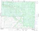
Maps showing Bob Hill, 20-22-25-W, Manitoba
Bob Hill is a Mountain located in 20-22-25-W, Manitoba and has an elevation of 655 meters.
- Latitude: 50° 55' North (decimal: 50.9166999)
- Longitude: 100° 54' West (decimal: -100.8999999)
- Topography Feature Category: Mountain
- Geographical Feature: Hill
- Canadian Province/Territory: Manitoba
- Elevation: 655 meters
- Location: 20-22-25-W
- Atlas of Canada Locator Map: Bob Hill
- GPS Coordinate Locator Map: Bob Hill Lat/Long
Bob Hill NTS Map Sheets