Canada Topographic Maps

Boggy Creek Topo Maps

Topography maps and Latitude/Longitude Location

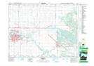
Maps showing Boggy Creek, Manitoba

Boggy Creek is a River located in Manitoba.

  • Latitude: 49° 53' 55'' North   (decimal: 49.8985999)
  • Longitude: 99° 41' 28'' West   (decimal: -99.6910999)
  • Topography Feature Category: River
  • Geographical Feature: Creek
  • Canadian Province/Territory: Manitoba
  • GPS Coordinate Locator Map: Boggy Creek Lat/Long

Boggy Creek NTS Map Sheets

062G13 Brandon Topographic Map at 1:50,000 scale

062G Brandon Topographic Map at 1:250,000 scale

 
Buy Topographic Maps DVD
Newsletter Sign-up

Yes, I want to receive map store discounts.


Bookmark and Share