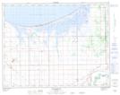
Maps showing Bone Pile Pothole, 18-14-6-W, Manitoba
Bone Pile Pothole is a Lake located in 18-14-6-W, Manitoba.
- Latitude: 50° 11' 40'' North (decimal: 50.1944000)
- Longitude: 98° 16' 3'' West (decimal: -98.2674999)
- Topography Feature Category: Lake
- Geographical Feature: Pothole
- Canadian Province/Territory: Manitoba
- Location: 18-14-6-W
- Atlas of Canada Locator Map: Bone Pile Pothole
- GPS Coordinate Locator Map: Bone Pile Pothole Lat/Long