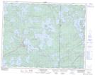
Maps showing Bostrom Island, Manitoba
Bostrom Island is a Island located in Manitoba and has an elevation of 331 meters.
- Latitude: 50° 9' 48'' North (decimal: 50.1633000)
- Longitude: 95° 14' 30'' West (decimal: -95.2417000)
- Topography Feature Category: Island
- Geographical Feature: Island
- Canadian Province/Territory: Manitoba
- Elevation: 331 meters
- Atlas of Canada Locator Map: Bostrom Island
- GPS Coordinate Locator Map: Bostrom Island Lat/Long
Bostrom Island NTS Map Sheets