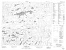
Maps showing Boutilier Lake, 18-70-16-W, Manitoba
Boutilier Lake is a Lake located in 18-70-16-W, Manitoba and has an elevation of 323 meters.
- Latitude: 55° 3' 23'' North (decimal: 55.0564000)
- Longitude: 99° 53' 2'' West (decimal: -99.8838999)
- Topography Feature Category: Lake
- Geographical Feature: Lake
- Canadian Province/Territory: Manitoba
- Elevation: 323 meters
- Location: 18-70-16-W
- Atlas of Canada Locator Map: Boutilier Lake
- GPS Coordinate Locator Map: Boutilier Lake Lat/Long
Boutilier Lake NTS Map Sheets