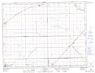
Maps showing Boyne Channel, 34-6-1-W, Manitoba
Boyne Channel is a Channel located in 34-6-1-W, Manitoba and has an elevation of 247 meters.
- Latitude: 49° 31' 55'' North (decimal: 49.5319000)
- Longitude: 97° 31' 7'' West (decimal: -97.5185999)
- Topography Feature Category: Channel
- Geographical Feature: Channel
- Canadian Province/Territory: Manitoba
- Elevation: 247 meters
- Location: 34-6-1-W
- Atlas of Canada Locator Map: Boyne Channel
- GPS Coordinate Locator Map: Boyne Channel Lat/Long