Canada Topographic Maps

Boyne River Topo Maps

Topography maps and Latitude/Longitude Location

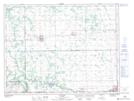
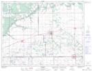
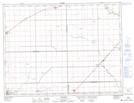
Maps showing Boyne River, 19-7-1-W, Manitoba

Boyne River is a River located in 19-7-1-W, Manitoba and has an elevation of 271 meters.

  • Latitude: 49° 34' 30'' North   (decimal: 49.5749999)
  • Longitude: 97° 34' 30'' West   (decimal: -97.5749999)
  • Topography Feature Category: River
  • Geographical Feature: River
  • Canadian Province/Territory: Manitoba
  • Elevation: 271 meters
  • Location: 19-7-1-W
  • Atlas of Canada Locator Map: Boyne River
  • GPS Coordinate Locator Map: Boyne River Lat/Long

Boyne River NTS Map Sheets

062G08 Miami Topographic Map at 1:50,000 scale

062G09 St Claude Topographic Map at 1:50,000 scale

062G10 Treherne Topographic Map at 1:50,000 scale

062H12 Brunkild Topographic Map at 1:50,000 scale

062G Brandon Topographic Map at 1:250,000 scale

062H Winnipeg Topographic Map at 1:250,000 scale

 
Buy Topographic Maps DVD
Newsletter Sign-up

Yes, I want to receive map store discounts.


Bookmark and Share