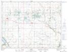
Maps showing Breaults Lake, 15,16-5-14-W, Manitoba
Breaults Lake is a Lake located in 15,16-5-14-W, Manitoba and has an elevation of 427 meters.
- Latitude: 49° 23' 36'' North (decimal: 49.3932999)
- Longitude: 99° 17' 7'' West (decimal: -99.2852999)
- Topography Feature Category: Lake
- Geographical Feature: Lake
- Canadian Province/Territory: Manitoba
- Elevation: 427 meters
- Location: 15,16-5-14-W
- Atlas of Canada Locator Map: Breaults Lake
- GPS Coordinate Locator Map: Breaults Lake Lat/Long