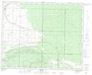
Maps showing Briggs Spur, 36-23-W, Manitoba
Briggs Spur is a Unincorporated area located in 36-23-W, Manitoba and has an elevation of 363 meters.
- Latitude: 52° 4' 44'' North (decimal: 52.0789000)
- Longitude: 100° 39' 11'' West (decimal: -100.6530999)
- Topography Feature Category: Unincorporated area
- Geographical Feature: Community
- Canadian Province/Territory: Manitoba
- Elevation: 363 meters
- Location: 36-23-W
- Atlas of Canada Locator Map: Briggs Spur
- GPS Coordinate Locator Map: Briggs Spur Lat/Long