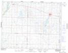
Maps showing Bryd, 14-17-24-W, Manitoba
Bryd is a Unincorporated area located in 14-17-24-W, Manitoba and has an elevation of 559 meters.
- Latitude: 50° 27' 22'' North (decimal: 50.4561000)
- Longitude: 100° 40' 13'' West (decimal: -100.6702999)
- Topography Feature Category: Unincorporated area
- Geographical Feature: Railway Point
- Canadian Province/Territory: Manitoba
- Elevation: 559 meters
- Location: 14-17-24-W
- Atlas of Canada Locator Map: Bryd
- GPS Coordinate Locator Map: Bryd Lat/Long
Bryd NTS Map Sheets