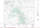
Maps showing Buck Hill, 29-12-13-W, Manitoba
Buck Hill is a Mountain located in 29-12-13-W, Manitoba.
- Latitude: 50° 2' 28'' North (decimal: 50.0411000)
- Longitude: 99° 12' 26'' West (decimal: -99.2072000)
- Topography Feature Category: Mountain
- Geographical Feature: Hill
- Canadian Province/Territory: Manitoba
- Location: 29-12-13-W
- Atlas of Canada Locator Map: Buck Hill
- GPS Coordinate Locator Map: Buck Hill Lat/Long