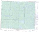
Maps showing Bulldog Creek, 30-22-17-E, Manitoba
Bulldog Creek is a River located in 30-22-17-E, Manitoba.
- Latitude: 50° 53' 59'' North (decimal: 50.8997000)
- Longitude: 95° 14' 14'' West (decimal: -95.2371999)
- Topography Feature Category: River
- Geographical Feature: Creek
- Canadian Province/Territory: Manitoba
- Location: 30-22-17-E
- Atlas of Canada Locator Map: Bulldog Creek
- GPS Coordinate Locator Map: Bulldog Creek Lat/Long
Bulldog Creek NTS Map Sheets