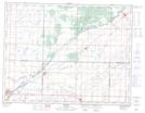
Maps showing Burnett Slough, 11,12-4-25-W, Manitoba
Burnett Slough is a Low vegetation located in 11,12-4-25-W, Manitoba and has an elevation of 454 meters.
- Latitude: 49° 17' 18'' North (decimal: 49.2883000)
- Longitude: 100° 43' 59'' West (decimal: -100.7330999)
- Topography Feature Category: Low vegetation
- Geographical Feature: Slough
- Canadian Province/Territory: Manitoba
- Elevation: 454 meters
- Location: 11,12-4-25-W
- Atlas of Canada Locator Map: Burnett Slough
- GPS Coordinate Locator Map: Burnett Slough Lat/Long