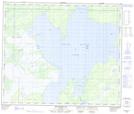
Maps showing Burntwood Bay Portage, 14-58-19-W, Manitoba
Burntwood Bay Portage is a Road feature located in 14-58-19-W, Manitoba and has an elevation of 273 meters.
- Latitude: 54° 1' 9'' North (decimal: 54.0192000)
- Longitude: 100° 10' 0'' West (decimal: -100.1667000)
- Topography Feature Category: Road feature
- Geographical Feature: Portage
- Canadian Province/Territory: Manitoba
- Elevation: 273 meters
- Location: 14-58-19-W
- Atlas of Canada Locator Map: Burntwood Bay Portage
- GPS Coordinate Locator Map: Burntwood Bay Portage Lat/Long
Burntwood Bay Portage NTS Map Sheets