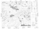
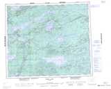
Maps showing Butterfly Lake, Manitoba
Butterfly Lake is a Lake located in Manitoba and has an elevation of 219 meters.
- Latitude: 54° 26' 33'' North (decimal: 54.4424999)
- Longitude: 97° 17' 12'' West (decimal: -97.2867000)
- Topography Feature Category: Lake
- Geographical Feature: Lake
- Canadian Province/Territory: Manitoba
- Elevation: 219 meters
- Atlas of Canada Locator Map: Butterfly Lake
- GPS Coordinate Locator Map: Butterfly Lake Lat/Long
Butterfly Lake NTS Map Sheets