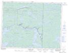
Maps showing Cabin Cut, Manitoba
Cabin Cut is a Channel located in Manitoba and has an elevation of 295 meters.
- Latitude: 50° 18' 10'' North (decimal: 50.3028000)
- Longitude: 95° 11' 57'' West (decimal: -95.1992000)
- Topography Feature Category: Channel
- Geographical Feature: Cut
- Canadian Province/Territory: Manitoba
- Elevation: 295 meters
- Atlas of Canada Locator Map: Cabin Cut
- GPS Coordinate Locator Map: Cabin Cut Lat/Long
Cabin Cut NTS Map Sheets