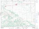
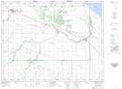
Maps showing Campbell Drain, 26-12-12-W, Manitoba
Campbell Drain is a Hydraulic construction located in 26-12-12-W, Manitoba and has an elevation of 309 meters.
- Latitude: 50° 2' 31'' North (decimal: 50.0419000)
- Longitude: 98° 59' 46'' West (decimal: -98.9961000)
- Topography Feature Category: Hydraulic construction
- Geographical Feature: Drain
- Canadian Province/Territory: Manitoba
- Elevation: 309 meters
- Location: 26-12-12-W
- Atlas of Canada Locator Map: Campbell Drain
- GPS Coordinate Locator Map: Campbell Drain Lat/Long
Campbell Drain NTS Map Sheets