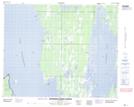
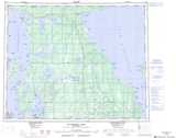
Maps showing Campbells Bluff, 11-36-16-W, Manitoba
Campbells Bluff is a Cliff located in 11-36-16-W, Manitoba and has an elevation of 260 meters.
- Latitude: 52° 4' 21'' North (decimal: 52.0724999)
- Longitude: 99° 38' 4'' West (decimal: -99.6344000)
- Topography Feature Category: Cliff
- Geographical Feature: Bluff
- Canadian Province/Territory: Manitoba
- Elevation: 260 meters
- Location: 11-36-16-W
- Atlas of Canada Locator Map: Campbells Bluff
- GPS Coordinate Locator Map: Campbells Bluff Lat/Long
Campbells Bluff NTS Map Sheets