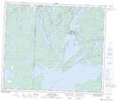
Maps showing Camp Whitney, 31-64-28-W, Manitoba
Camp Whitney is a Unincorporated area located in 31-64-28-W, Manitoba.
- Latitude: 54° 35' 42'' North (decimal: 54.5950000)
- Longitude: 101° 41' 28'' West (decimal: -101.6910999)
- Topography Feature Category: Unincorporated area
- Geographical Feature: Railway Point
- Canadian Province/Territory: Manitoba
- Location: 31-64-28-W
- GPS Coordinate Locator Map: Camp Whitney Lat/Long
Camp Whitney NTS Map Sheets