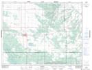
Maps showing Carberry Junction, 30-10-14-W, Manitoba
Carberry Junction is a Unincorporated area located in 30-10-14-W, Manitoba and has an elevation of 370 meters.
- Latitude: 49° 51' 55'' North (decimal: 49.8653000)
- Longitude: 99° 21' 12'' West (decimal: -99.3533000)
- Topography Feature Category: Unincorporated area
- Geographical Feature: Locality
- Canadian Province/Territory: Manitoba
- Elevation: 370 meters
- Location: 30-10-14-W
- Atlas of Canada Locator Map: Carberry Junction
- GPS Coordinate Locator Map: Carberry Junction Lat/Long