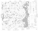
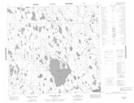
Maps showing Carefoot Lake, Manitoba
Carefoot Lake is a Lake located in Manitoba and has an elevation of 293 meters.
- Latitude: 58° 14' 19'' North (decimal: 58.2385999)
- Longitude: 97° 25' 34'' West (decimal: -97.4260999)
- Topography Feature Category: Lake
- Geographical Feature: Lake
- Canadian Province/Territory: Manitoba
- Elevation: 293 meters
- Atlas of Canada Locator Map: Carefoot Lake
- GPS Coordinate Locator Map: Carefoot Lake Lat/Long
Carefoot Lake NTS Map Sheets