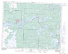
Maps showing Caribou Creek, 25-13-12-E, Manitoba
Caribou Creek is a River located in 25-13-12-E, Manitoba and has an elevation of 274 meters.
- Latitude: 50° 6' 41'' North (decimal: 50.1114000)
- Longitude: 95° 50' 35'' West (decimal: -95.8430999)
- Topography Feature Category: River
- Geographical Feature: Creek
- Canadian Province/Territory: Manitoba
- Elevation: 274 meters
- Location: 25-13-12-E
- Atlas of Canada Locator Map: Caribou Creek
- GPS Coordinate Locator Map: Caribou Creek Lat/Long
Caribou Creek NTS Map Sheets