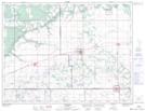
Maps showing Carie Flats, Manitoba
Carie Flats is a Beach located in Manitoba and has an elevation of 304 meters.
- Latitude: 49° 43' 0'' North (decimal: 49.7167000)
- Longitude: 98° 57' 9'' West (decimal: -98.9525000)
- Topography Feature Category: Beach
- Geographical Feature: Flats
- Canadian Province/Territory: Manitoba
- Elevation: 304 meters
- Atlas of Canada Locator Map: Carie Flats
- GPS Coordinate Locator Map: Carie Flats Lat/Long