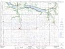
Maps showing Cartwright, 6-2-14-W, Manitoba
Cartwright is a Village located in 6-2-14-W, Manitoba and has an elevation of 458 meters.
- Latitude: 49° 5' 44'' North (decimal: 49.0956000)
- Longitude: 99° 20' 24'' West (decimal: -99.3400000)
- Topography Feature Category: Village
- Geographical Feature: Village
- Canadian Province/Territory: Manitoba
- Elevation: 458 meters
- Location: 6-2-14-W
- Atlas of Canada Locator Map: Cartwright
- GPS Coordinate Locator Map: Cartwright Lat/Long