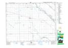
Maps showing Cekanauskas Creek, 26-9-2-W, Manitoba
Cekanauskas Creek is a River located in 26-9-2-W, Manitoba and has an elevation of 240 meters.
- Latitude: 49° 46' 27'' North (decimal: 49.7741999)
- Longitude: 97° 37' 31'' West (decimal: -97.6252999)
- Topography Feature Category: River
- Geographical Feature: Creek
- Canadian Province/Territory: Manitoba
- Elevation: 240 meters
- Location: 26-9-2-W
- Atlas of Canada Locator Map: Cekanauskas Creek
- GPS Coordinate Locator Map: Cekanauskas Creek Lat/Long