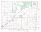
Maps showing Chain Lakes, 2,3,12-5-23-W, Manitoba
Chain Lakes is a Lake located in 2,3,12-5-23-W, Manitoba and has an elevation of 473 meters.
- Latitude: 49° 22' 9'' North (decimal: 49.3691999)
- Longitude: 100° 28' 40'' West (decimal: -100.4778000)
- Topography Feature Category: Lake
- Geographical Feature: Lakes
- Canadian Province/Territory: Manitoba
- Elevation: 473 meters
- Location: 2,3,12-5-23-W
- Atlas of Canada Locator Map: Chain Lakes
- GPS Coordinate Locator Map: Chain Lakes Lat/Long
Chain Lakes NTS Map Sheets