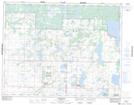
Maps showing Clear Lake, 19,20-18,19-W, Manitoba
Clear Lake is a Lake located in 19,20-18,19-W, Manitoba and has an elevation of 615 meters.
- Latitude: 50° 40' 32'' North (decimal: 50.6756000)
- Longitude: 99° 60' 00'' West (decimal: -99.9999999)
- Topography Feature Category: Lake
- Geographical Feature: Lake
- Canadian Province/Territory: Manitoba
- Elevation: 615 meters
- Location: 19,20-18,19-W
- Atlas of Canada Locator Map: Clear Lake
- GPS Coordinate Locator Map: Clear Lake Lat/Long
Clear Lake NTS Map Sheets