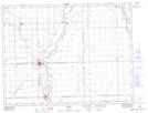
Maps showing Clubb Coulee, Manitoba
Clubb Coulee is a River located in Manitoba and has an elevation of 237 meters.
- Latitude: 49° 18' 52'' North (decimal: 49.3144000)
- Longitude: 97° 20' 15'' West (decimal: -97.3375000)
- Topography Feature Category: River
- Geographical Feature: Coulee
- Canadian Province/Territory: Manitoba
- Elevation: 237 meters
- Atlas of Canada Locator Map: Clubb Coulee
- GPS Coordinate Locator Map: Clubb Coulee Lat/Long