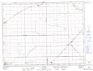
Maps showing Codnor Drain, 22-9-2-W, Manitoba
Codnor Drain is a Hydraulic construction located in 22-9-2-W, Manitoba and has an elevation of 240 meters.
- Latitude: 49° 45' 48'' North (decimal: 49.7632999)
- Longitude: 97° 38' 43'' West (decimal: -97.6452999)
- Topography Feature Category: Hydraulic construction
- Geographical Feature: Drain
- Canadian Province/Territory: Manitoba
- Elevation: 240 meters
- Location: 22-9-2-W
- Atlas of Canada Locator Map: Codnor Drain
- GPS Coordinate Locator Map: Codnor Drain Lat/Long
Codnor Drain NTS Map Sheets