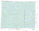
Maps showing Cole Lake, 19-16-E, Manitoba
Cole Lake is a Lake located in 19-16-E, Manitoba and has an elevation of 331 meters.
- Latitude: 50° 34' 52'' North (decimal: 50.5810999)
- Longitude: 95° 17' 49'' West (decimal: -95.2969000)
- Topography Feature Category: Lake
- Geographical Feature: Lake
- Canadian Province/Territory: Manitoba
- Elevation: 331 meters
- Location: 19-16-E
- Atlas of Canada Locator Map: Cole Lake
- GPS Coordinate Locator Map: Cole Lake Lat/Long
Cole Lake NTS Map Sheets