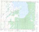
Maps showing Community Pasture Drain, 18-39-24-W, Manitoba
Community Pasture Drain is a Hydraulic construction located in 18-39-24-W, Manitoba.
- Latitude: 52° 21' 42'' North (decimal: 52.3617000)
- Longitude: 100° 54' 15'' West (decimal: -100.9041999)
- Topography Feature Category: Hydraulic construction
- Geographical Feature: Drain
- Canadian Province/Territory: Manitoba
- Location: 18-39-24-W
- Atlas of Canada Locator Map: Community Pasture Drain
- GPS Coordinate Locator Map: Community Pasture Drain Lat/Long