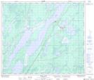
Maps showing Conlin Lake Camp, 67-8-W, Manitoba
Conlin Lake Camp is a Unincorporated area located in 67-8-W, Manitoba and has an elevation of 230 meters.
- Latitude: 54° 49' 17'' North (decimal: 54.8213999)
- Longitude: 98° 36' 45'' West (decimal: -98.6125000)
- Topography Feature Category: Unincorporated area
- Geographical Feature: Locality
- Canadian Province/Territory: Manitoba
- Elevation: 230 meters
- Location: 67-8-W
- Atlas of Canada Locator Map: Conlin Lake Camp
- GPS Coordinate Locator Map: Conlin Lake Camp Lat/Long
Conlin Lake Camp NTS Map Sheets