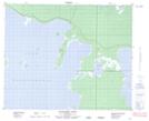
Maps showing Cormorant Point, Manitoba
Cormorant Point is a Island located in Manitoba and has an elevation of 251 meters.
- Latitude: 52° 51' 36'' North (decimal: 52.8600000)
- Longitude: 99° 56' 50'' West (decimal: -99.9472000)
- Topography Feature Category: Island
- Geographical Feature: Island
- Canadian Province/Territory: Manitoba
- Elevation: 251 meters
- Atlas of Canada Locator Map: Cormorant Point
- GPS Coordinate Locator Map: Cormorant Point Lat/Long
Cormorant Point NTS Map Sheets